Path Analysis
Each of your coverage and multi maps has the option to move a green pin anywhere on the map you wish. This pin is a point, which represents a GPS location. You can also use the address search field to find addresses via Geo Location from Google. By placing this pin then selecting Path Analysis, (Located in the lower left section of a coverage or the lower middle section of a Multi Map) a path Analysis will start. On multi-maps, it will be a multi path analysis to the six BEST Links, but on a single coverage map, it will simply be to that tower site radio system only.
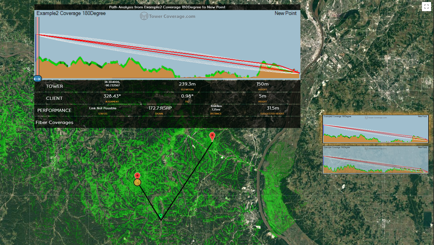
The above image is what you get when you are on a multi map. It will process for a short time, and then will display the path analysis to the six best Coverages. This data is generated on the fly, and not stored. Note this that is also a condensed version of the full path analysis that is done in the links section.
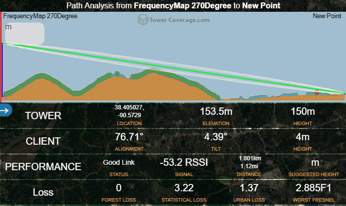
Doing a path analysis on a single coverage allows you to save data, this includes a site name and a link name. We automatically create the site based on the GPS location of the green pin, and then create a link path to save the data to.
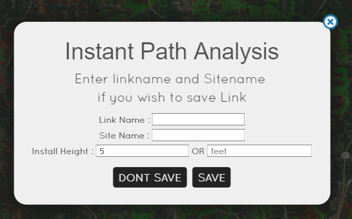
In the above image, we have the options to save or not to save the Instant Path Analysis. If you do not save and provide the link and site name, it will simply process and display the link path. For more information on link creation and the results that follow, please see the links section.
Worst Fresnel Zone Value