Multi Map - Frequency Usage
At the bottom left of your screen you'll see a button titled frequency overlays. This is a system that is designed to help you with interference planning. This system uses three items on coverage maps; the max distance, the exact center frequency, and the color picker that allows you to set the color for that frequency.
Within the coverage settings the exact center frequency is an optional setting. If you elect to use this setting, it will utilize the max distance along with your tower site locations, to then plot where that frequency would interfere with other radios in the air.
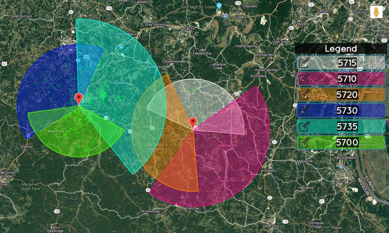
This tool does not look at ground heights, or land cover data, it simply shows a color (selected by you) for each channel that you are operating on. If two radios have the same channel, then you would set them as the same color. Below is an example of three sites using three different channels. Based on their antenna type, we will project a radius out to the max distance variable. This gives you the opportunity to see what is close to the same frequency.
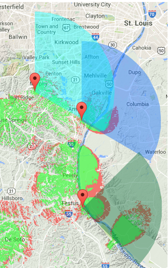
Here is another example of frequency coverage. However, the tower near Desoto is a sector antenna, and is using the same channel as the antennas in the upper and lower left of the image. This shows a prime example of an antenna that is within the beam width of the Antenna’s pattern. This gives us a graphical view that the upper left radio will have direct interference from the Desoto radio. Our own radios are causing self-interference.
When you select Frequency Overlays, the map will display a drop down for the frequency group options. Here we have the most commonly used frequency ranges. Each time you select one the map will reload with the new group of frequencies.