1 Meter Clutter Data
1 Meter Clutter Data is now available for accounts Tier 3 and above.
- When users create a site the header will show a message confirming data availability.
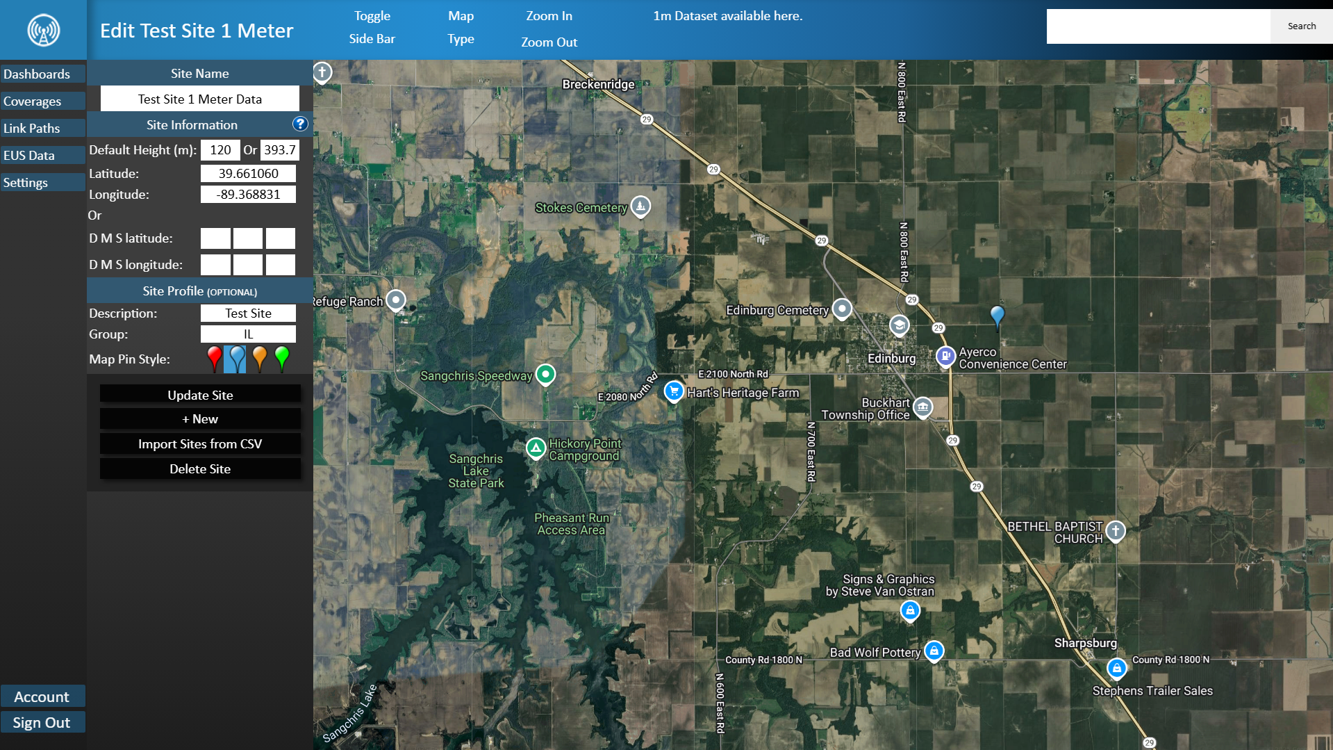
1 Meter Data on Site Creation Interface
This confirmation is also available on coverage maps along with the option to upgrade if your account is of a lower tier.
Under the Settings tab in TowerCoverage there is a 1 Meter Clutter Data Map which shows all 1 Meter Clutter Data available in gray.
Data Map
This map will be kept updated as more data becomes available.
Setting your coverage to specific rendering qualities may override your current land clutter settings. See chart below for further explanation.
Settings by Rendering Quality
- ULTRA = highest available clutter and elevation data.
- VERY HIGH = up to 1/9th arc second clutter where available and highest available elevation data.
- HIGH = up to 1/9th arc second clutter and elevation where available.
- MEDIUM = 1/3 arc second for clutter, 1/9th elevation where available.
- LOW = 1/3 arc sec data for both.
- VERY LOW = 1 arc second data for both